Pre-Worboys sign, Bocking Church Street
Introduction
The photograph on this page of Pre-Worboys sign, Bocking Church Street by David Howard as part of the Geograph project.
The Geograph project started in 2005 with the aim of publishing, organising and preserving representative images for every square kilometre of Great Britain, Ireland and the Isle of Man.

There are currently over 7.5m images from over 14,400 individuals and you can help contribute to the project by visiting https://www.geograph.org.uk
Pre-Worboys sign, Bocking Church Street
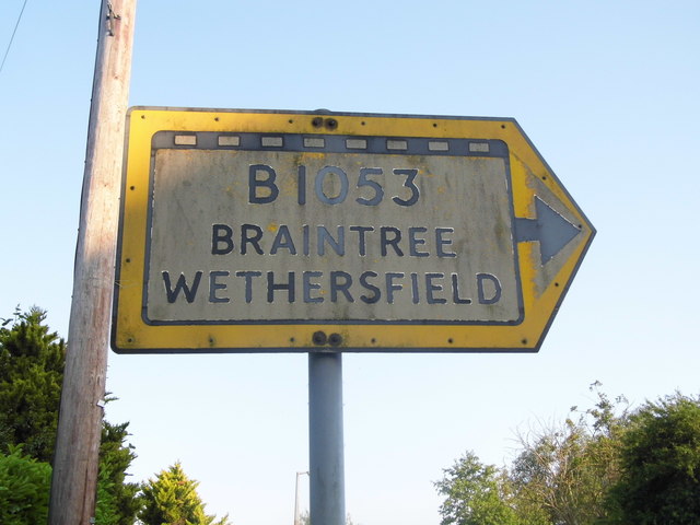
Image: © David Howard Taken: 6 Jun 2013
Yellow bordered arrows were used in urban areas and sometimes elsewhere like this suburban example. The dotted line above the road number means 'leading to' the B1053.
Images are licensed for reuse under creativecommons.org/licenses/by-sa/2.0
Image Location
Latitude
51.900578
Longitude
0.553858