Former entrance to Woburn Park
Introduction
The photograph on this page of Former entrance to Woburn Park by Derek Harper as part of the Geograph project.
The Geograph project started in 2005 with the aim of publishing, organising and preserving representative images for every square kilometre of Great Britain, Ireland and the Isle of Man.

There are currently over 7.5m images from over 14,400 individuals and you can help contribute to the project by visiting https://www.geograph.org.uk
Former entrance to Woburn Park
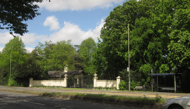
Image: © Derek Harper Taken: 10 May 2013
Another view showing the former entrance to Woburn Park and its lodge seen in Image, with a bus stop handy; it's described at https://historicengland.org.uk/listing/the-list/list-entry/1000342 as "a single-storey stucco lodge is situated on the west side of the original access drive, c 170m south-south-east of the house, behind a bellmouth of 1.5m high stucco walls and two pillars surmounted by urns". looking across the A317 dual carriageway from the bridge over The Bourne.
Images are licensed for reuse under creativecommons.org/licenses/by-sa/2.0
Image Location
Latitude
51.374621
Longitude
-0.478471