Along Bargoed Viaduct
Introduction
The photograph on this page of Along Bargoed Viaduct by Jaggery as part of the Geograph project.
The Geograph project started in 2005 with the aim of publishing, organising and preserving representative images for every square kilometre of Great Britain, Ireland and the Isle of Man.

There are currently over 7.5m images from over 14,400 individuals and you can help contribute to the project by visiting https://www.geograph.org.uk
Along Bargoed Viaduct
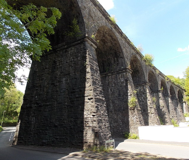
Image: © Jaggery Taken: 1 Jun 2013
Viewed from Factory Road. The viaduct carries the Rhymney Line about 250 metres NW of Bargoed railway station. The next station ahead is Brithdir. The viaduct was Grade II listed in 2002 as a visually imposing and fine example of 19th century civil engineering.
Images are licensed for reuse under creativecommons.org/licenses/by-sa/2.0
Image Location
Latitude
51.695167
Longitude
-3.231349