
Holderness Road, Kingston upon Hull
Introduction
The photograph on this page of Holderness Road, Kingston upon Hull by Bernard Sharp as part of the Geograph project.
The Geograph project started in 2005 with the aim of publishing, organising and preserving representative images for every square kilometre of Great Britain, Ireland and the Isle of Man.

There are currently over 7.5m images from over 14,400 individuals and you can help contribute to the project by visiting https://www.geograph.org.uk
Holderness Road, Kingston upon Hull
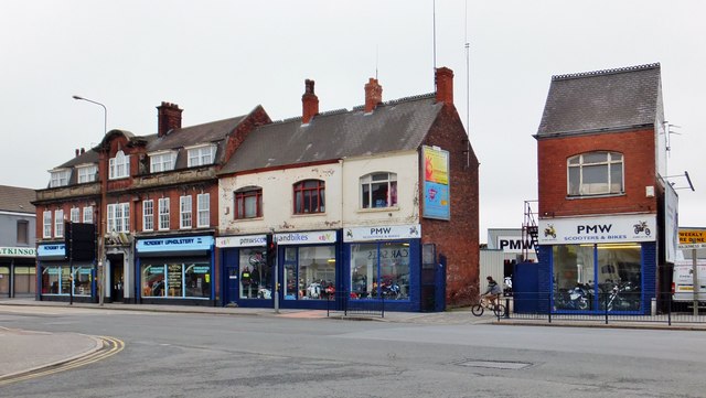
Image: © Bernard Sharp Taken: 30 May 2013
At the junction with Thomas Street, Nos.26-32 Holderness Road, built 1929 for the Hull & Sculcoates Dispensary. A superb example of Neo-Georgian architecture, featuring good doorcases with scrolled and segmental pediments. The date stone, above the central first-floor window, reads: '. A . 1929 . D .' The Dispensary was founded 1814 for the poor. It entered into voluntary liquidation 1958 when the Holderness Road branch was sold, the proceeds to the Hull & Sculcoates Dispensary Aid Trust. Now occupied by Academy Upholstery. Adjoining, at Nos.16-24, four former houses, late 19th century, now occupied by PMW Scooters & Bikes. The gap between Nos. 16 and 20 is the entrance to the former Blockhouse Mill yard.
Images are licensed for reuse under creativecommons.org/licenses/by-sa/2.0
Image Location

Latitude
53.748488
Longitude
-0.321548