Crumbling Roadway
Introduction
The photograph on this page of Crumbling Roadway by Anne Burgess as part of the Geograph project.
The Geograph project started in 2005 with the aim of publishing, organising and preserving representative images for every square kilometre of Great Britain, Ireland and the Isle of Man.

There are currently over 7.5m images from over 14,400 individuals and you can help contribute to the project by visiting https://www.geograph.org.uk
Crumbling Roadway
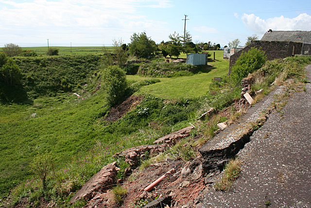
Image: © Anne Burgess Taken: 1 Jun 2013
The edge of the old main road at Bush is splitting and slipping downhill. The remains of the parapet can be seen lying on the grass a few feet down the slope. The embankment at the far side of the dip is the former railway line to Inverbervie.
Images are licensed for reuse under creativecommons.org/licenses/by-sa/2.0
Image Location
Latitude
56.784412
Longitude
-2.389667