Laying out track
Introduction
The photograph on this page of Laying out track by Alan Murray-Rust as part of the Geograph project.
The Geograph project started in 2005 with the aim of publishing, organising and preserving representative images for every square kilometre of Great Britain, Ireland and the Isle of Man.

There are currently over 7.5m images from over 14,400 individuals and you can help contribute to the project by visiting https://www.geograph.org.uk
Laying out track
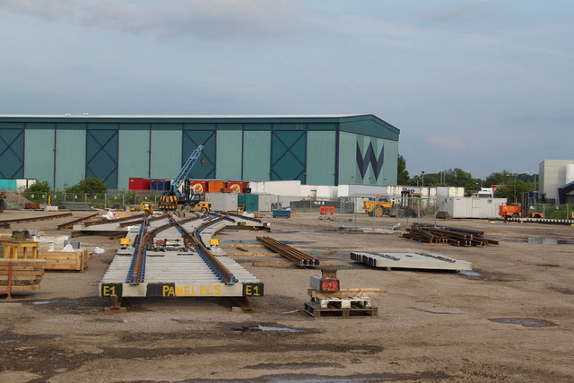
Image: © Alan Murray-Rust Taken: 31 May 2013
A new use for part of the old Stanton Ironworks site. The level concrete base of a demolished building makes an ideal location. By setting out the track like this, it can be accurately set up in advance, then broken down into smaller sections so that the final installation can be carried out in the shortest possible time, thus minimising disruption to train services. This could be part of the forthcoming remodelling of Nottingham Station.
Images are licensed for reuse under creativecommons.org/licenses/by-sa/2.0
Image Location
Latitude
52.942215
Longitude
-1.289408