Portobello Dock
Introduction
The photograph on this page of Portobello Dock by David Hawgood as part of the Geograph project.
The Geograph project started in 2005 with the aim of publishing, organising and preserving representative images for every square kilometre of Great Britain, Ireland and the Isle of Man.

There are currently over 7.5m images from over 14,400 individuals and you can help contribute to the project by visiting https://www.geograph.org.uk
Portobello Dock
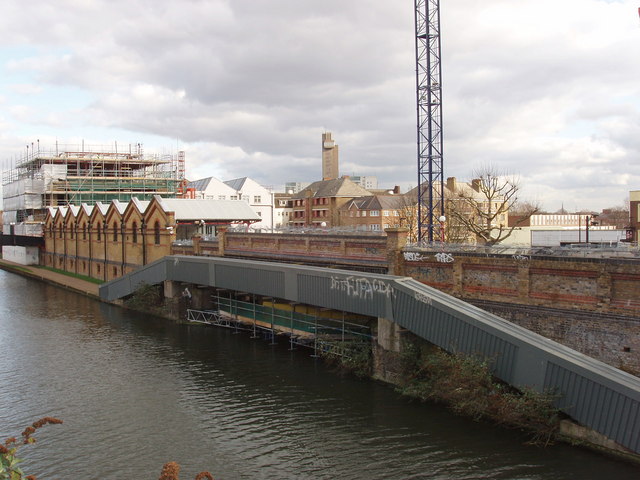
Image: © David Hawgood Taken: 26 Feb 2007
There is a substantial new development on this site which was recently the offices of Virgin Emi Records. For artist's impression of new development see New London Architecture http://www.newlondonarchitecture.org/project.php?id=115. The Greater London Industrial Heritage Society http://www.glias.org.uk/news/228news.html#F tells us the site's history: "At the corner of Ladbroke Grove and Kensal Road, is the former Paddington Vestry Refuse Transfer Depot, later known as Corporation Yard and, more recently, as Porta Bella Dock, until taken over by EMI as part of their headquarter complex, which included buildings across the canal. The depot was used to transfer refuse from carts to barges, with a covered wharf, ramp and bridges, circa 1880 and is Grade II listed." The site includes Kensal House Image linked by footbridge over the canal.
Images are licensed for reuse under creativecommons.org/licenses/by-sa/2.0
Image Location
Latitude
51.526824
Longitude
-0.214348