St. Mary's bridge, over the River Brit, Bridport
Introduction
The photograph on this page of St. Mary's bridge, over the River Brit, Bridport by Stephen Williams as part of the Geograph project.
The Geograph project started in 2005 with the aim of publishing, organising and preserving representative images for every square kilometre of Great Britain, Ireland and the Isle of Man.

There are currently over 7.5m images from over 14,400 individuals and you can help contribute to the project by visiting https://www.geograph.org.uk
St. Mary's bridge, over the River Brit, Bridport
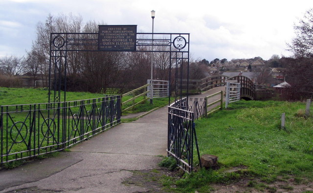
Image: © Stephen Williams Taken: 25 Feb 2007
This is a lovely wooden footbridge over the River Brit, between Priory Lane and St. Mary's playing field in Bridport. It saves a long walk via either the Dreadnought trading estate or Skilling Hill Road. The sign says: "Erected by public submission to commemorate the coronation of King George VI and Queen Elizabeth. May 12 1937. H.R.C. Palmer, Mayor".
Images are licensed for reuse under creativecommons.org/licenses/by-sa/2.0
Image Location


Leaflet Map data © OpenStreetMap
Latitude
50.729816
Longitude
-2.760242