Ordnance Survey bolt on St George's Church
Introduction
The photograph on this page of Ordnance Survey bolt on St George's Church by Shantavira as part of the Geograph project.
The Geograph project started in 2005 with the aim of publishing, organising and preserving representative images for every square kilometre of Great Britain, Ireland and the Isle of Man.

There are currently over 7.5m images from over 14,400 individuals and you can help contribute to the project by visiting https://www.geograph.org.uk
Ordnance Survey bolt on St George's Church
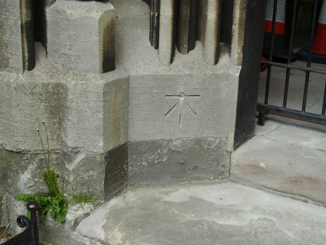
Image: © Shantavira Taken: 25 May 2013
This Ordnance Survey bench mark with bolt was established during the First primary levelling of England & Wales, and was levelled (between September 1849 and November 1855) with a height of 189.4580 feet [57.7468 metres] above mean sea level (Liverpool datum). It was included on the Worcester to Aberystwyth (Branch Levelling from Stourport to Kidderminster) levelling line. The surveyor's description was "Bolt in West face of St. George's Church; 2.01 ft. above surface." (page 558)
Images are licensed for reuse under creativecommons.org/licenses/by-sa/2.0
Image Location
Latitude
52.390235
Longitude
-2.242851