Wray Lane
Introduction
The photograph on this page of Wray Lane by Ian Capper as part of the Geograph project.
The Geograph project started in 2005 with the aim of publishing, organising and preserving representative images for every square kilometre of Great Britain, Ireland and the Isle of Man.

There are currently over 7.5m images from over 14,400 individuals and you can help contribute to the project by visiting https://www.geograph.org.uk
Wray Lane
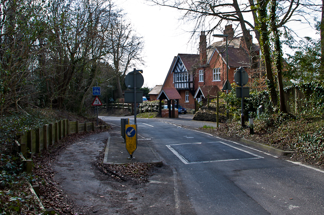
Image: © Ian Capper Taken: 2 Apr 2013
Wray Lane is used as a route from Redhill and Wray Common to the top of Reigate Hill, where Junction 8 of the M25 is situated. Originally two way, it was made one way only at the top end in the late 1980s or so. Here is the start of the one way section, with a speed ramp to reduce speeding. On the left is the end of a short stretch of contraflow cycle lane, linking from a bridleway from Gatton Park.
Images are licensed for reuse under creativecommons.org/licenses/by-sa/2.0
Image Location


Leaflet Map data © OpenStreetMap
Latitude
51.252769
Longitude
-0.188873