Rosedale Manor, Harelaw
Introduction
The photograph on this page of Rosedale Manor, Harelaw by Robert Graham as part of the Geograph project.
The Geograph project started in 2005 with the aim of publishing, organising and preserving representative images for every square kilometre of Great Britain, Ireland and the Isle of Man.

There are currently over 7.5m images from over 14,400 individuals and you can help contribute to the project by visiting https://www.geograph.org.uk
Rosedale Manor, Harelaw
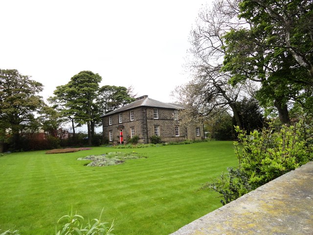
Image: © Robert Graham Taken: 23 May 2013
This fine old house isn't actually a manor; it was built in 1840 as the vicarage for the village of Harelaw. It looks a very grand vicarage for a little village, but in those days Harelaw was a more important place than it is today. It was originally part of the Township of Kyo, which dates from the early middle ages. Many of the surrounding villages didn't exist then; they date only from the 18th or 19th centuries and the start of the coalmining industry.
Images are licensed for reuse under creativecommons.org/licenses/by-sa/2.0
Image Location
Latitude
54.869627
Longitude
-1.750349