The Bridge Inn
Introduction
The photograph on this page of The Bridge Inn by Ian Capper as part of the Geograph project.
The Geograph project started in 2005 with the aim of publishing, organising and preserving representative images for every square kilometre of Great Britain, Ireland and the Isle of Man.

There are currently over 7.5m images from over 14,400 individuals and you can help contribute to the project by visiting https://www.geograph.org.uk
The Bridge Inn
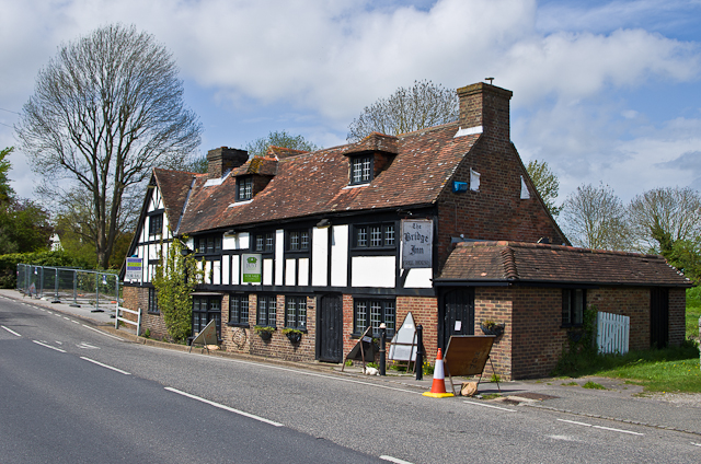
Image: © Ian Capper Taken: 11 May 2013
Originally built in 1545 as a Customs House for the port of Winchelsea, it has been added to and altered over the years. Its use as a pub goes back to at least 1878 (see http://pubshistory.com/SussexPubs/Rye/BridgeInn.shtml) but ceased in 2009 when it closed. Planning permission was granted in 2012 for its conversion to residential use.
Images are licensed for reuse under creativecommons.org/licenses/by-sa/2.0
Image Location


Leaflet Map data © OpenStreetMap
Latitude
50.925766
Longitude
0.713596