South Norwood High Street
Introduction
The photograph on this page of South Norwood High Street by Christopher Hilton as part of the Geograph project.
The Geograph project started in 2005 with the aim of publishing, organising and preserving representative images for every square kilometre of Great Britain, Ireland and the Isle of Man.

There are currently over 7.5m images from over 14,400 individuals and you can help contribute to the project by visiting https://www.geograph.org.uk
South Norwood High Street
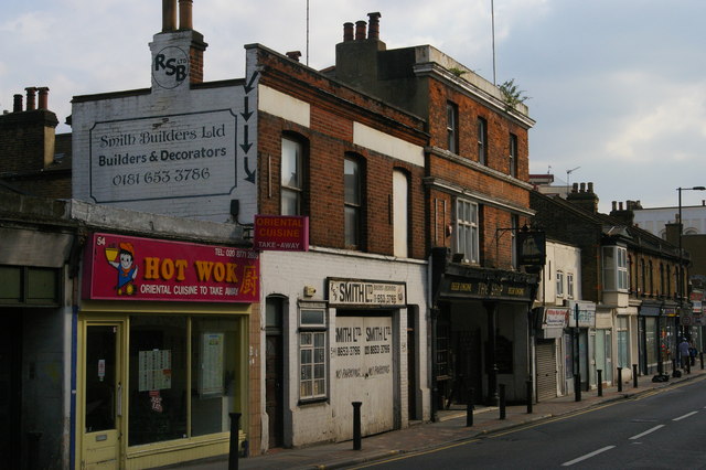
Image: © Christopher Hilton Taken: 19 May 2013
Possibly because of the former presence of the Croydon Canal - the gardens of the buildings shown here used to stretch down to its banks, before the railway took over its course - the pubs on South Norwood High Street have a nautical theme: the Ship here is joined a little further on by the Albion (whose sign shows a ship of the line) and the Jolly Sailor.
Images are licensed for reuse under creativecommons.org/licenses/by-sa/2.0
Image Location
Latitude
51.400227
Longitude
-0.073505