Site of former station at Epworth, 1995
Introduction
The photograph on this page of Site of former station at Epworth, 1995 by Ben Brooksbank as part of the Geograph project.
The Geograph project started in 2005 with the aim of publishing, organising and preserving representative images for every square kilometre of Great Britain, Ireland and the Isle of Man.

There are currently over 7.5m images from over 14,400 individuals and you can help contribute to the project by visiting https://www.geograph.org.uk
Site of former station at Epworth, 1995
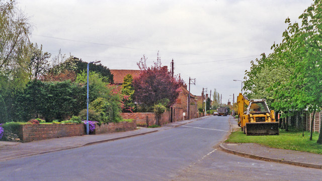
Image: © Ben Brooksbank Taken: 27 Apr 1995
View NW on Station Road, where the Isle of Axholme (L&Y & NER) Light Railway crossed, Goole (to right) - Haxey Junction (to left). The station was on the left and closed to passengers on 17/7/33, but the line remained open for goods until 2/2/56.
Images are licensed for reuse under creativecommons.org/licenses/by-sa/2.0
Image Location
Latitude
53.530278
Longitude
-0.831839