Lambley NG4, Notts.
Introduction
The photograph on this page of Lambley NG4, Notts. by David Hallam-Jones as part of the Geograph project.
The Geograph project started in 2005 with the aim of publishing, organising and preserving representative images for every square kilometre of Great Britain, Ireland and the Isle of Man.

There are currently over 7.5m images from over 14,400 individuals and you can help contribute to the project by visiting https://www.geograph.org.uk
Lambley NG4, Notts.
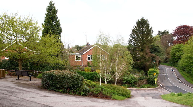
Image: © David Hallam-Jones Taken: 12 May 2013
Sandwiched between Grange Close and the village cemetery is this quiet, recreational area overlooking Park Lane. The cyclist may well be heading towards Heanor and if so, s/he'll pass The Green, an access road to H.M.P Lowdham Grange. Lambley village lays behind the cyclist. To the left of the bench is "The Millennium Oak", planted to celebrate that event.
Images are licensed for reuse under creativecommons.org/licenses/by-sa/2.0
Image Location
Latitude
53.001181
Longitude
-1.055982