Crookes Valley Road, Crookes Valley, Sheffield
Introduction
The photograph on this page of Crookes Valley Road, Crookes Valley, Sheffield by Terry Robinson as part of the Geograph project.
The Geograph project started in 2005 with the aim of publishing, organising and preserving representative images for every square kilometre of Great Britain, Ireland and the Isle of Man.

There are currently over 7.5m images from over 14,400 individuals and you can help contribute to the project by visiting https://www.geograph.org.uk
Crookes Valley Road, Crookes Valley, Sheffield
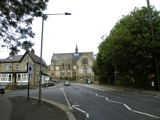
Image: © Terry Robinson Taken: 1 Sep 2012
Harcourt Road runs off to the left. The former, but now disused and dilapidated, Crookes Valley Methodist Church is at the top of the road, which bends around to the left of the Church and forms a junction with Crookesmoor Road and Barber Road.
Images are licensed for reuse under creativecommons.org/licenses/by-sa/2.0
Image Location
Latitude
53.38534
Longitude
-1.493594