Railway Tracks
Introduction
The photograph on this page of Railway Tracks by Wilson Adams as part of the Geograph project.
The Geograph project started in 2005 with the aim of publishing, organising and preserving representative images for every square kilometre of Great Britain, Ireland and the Isle of Man.

There are currently over 7.5m images from over 14,400 individuals and you can help contribute to the project by visiting https://www.geograph.org.uk
Railway Tracks
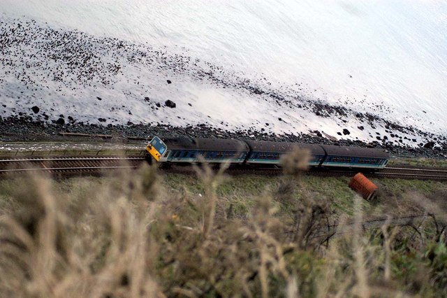
Image: © Wilson Adams Taken: 24 Mar 2004
A view from the Bla' Hole, Image of a train travelling towards Belfast in grid Image The train is on the Up line travelling towards Belfast, this section of line is now single track between Whitehead and the Salt Mines at Killroot. The railway line to the right of the train, is the now disused Down line from Belfast to Whitehead and Larne Harbour. This line passes through Whitehead Tunnel, before reaching Whitehead. The area between the two tracks, was where the original Whitehead Station once stood. A word of advice for anyone wanting to recreate an image similar to this one is "DON'T!, as I was standing two feet from the cliff edge, and it's an approx sheer drop of 800 foot to the railway lines below.
Images are licensed for reuse under creativecommons.org/licenses/by-sa/2.0
Image Location


Leaflet Map data © OpenStreetMap
Latitude
54.749791
Longitude
-5.709961