
Liverpool: Wavertree Town Hall, High Street, L15
Introduction
The photograph on this page of Liverpool: Wavertree Town Hall, High Street, L15 by Nigel Cox as part of the Geograph project.
The Geograph project started in 2005 with the aim of publishing, organising and preserving representative images for every square kilometre of Great Britain, Ireland and the Isle of Man.

There are currently over 7.5m images from over 14,400 individuals and you can help contribute to the project by visiting https://www.geograph.org.uk
Liverpool: Wavertree Town Hall, High Street, L15
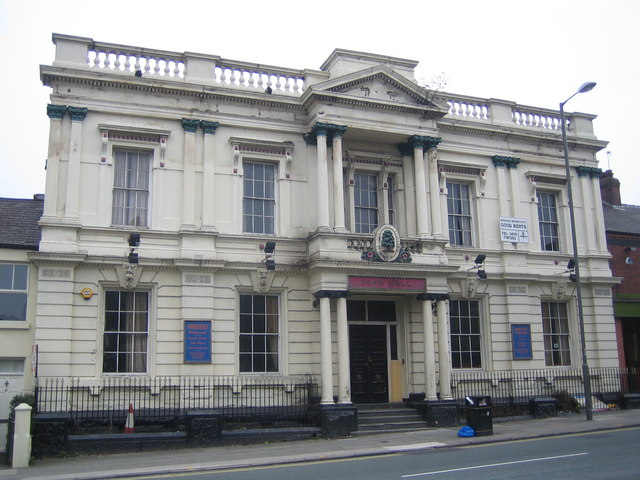
Image: © Nigel Cox Taken: 19 Feb 2007
This Grade II listed building was constructed in 1872 as Wavertree Town Hall, the name and date appearing in the maroon tablet above the entrance. After the absorbtion of Wavertree into the municipality of Liverpool in 1895, it was used as a local rates collection centre and as a Registry Office for many years. In 1979, after a period of disuse and the threat of demolition it was converted into a public house with a restaurant and function rooms. The oval tablet above the entrance contains a tree and has the Latin inscription "Sub Umbra Floresco", which loosely translates into "In the shade I flourish", almost certainly a reference to Wavertree's former independence of Liverpool.
Images are licensed for reuse under creativecommons.org/licenses/by-sa/2.0
Image Location

Latitude
53.397887
Longitude
-2.918856