The Assembly
Introduction
The photograph on this page of The Assembly by Ian Capper as part of the Geograph project.
The Geograph project started in 2005 with the aim of publishing, organising and preserving representative images for every square kilometre of Great Britain, Ireland and the Isle of Man.

There are currently over 7.5m images from over 14,400 individuals and you can help contribute to the project by visiting https://www.geograph.org.uk
The Assembly
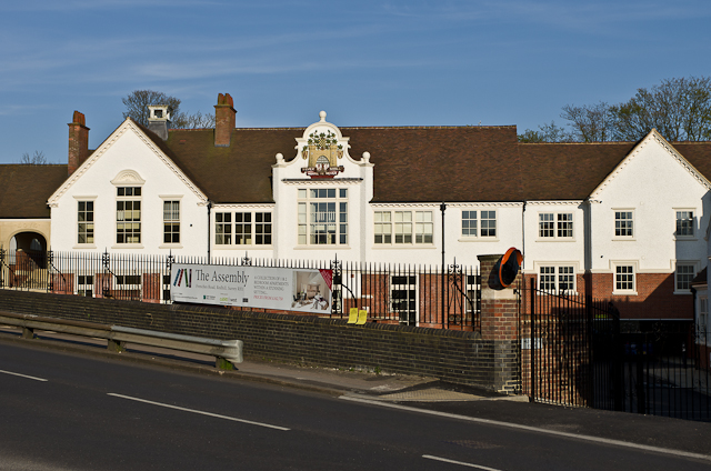
Image: © Ian Capper Taken: 2 May 2013
2012 redevelopment for housing of the former Frenches Road School, built in 1905 to the design of John Moir Kennard (1857-1950). Old maps show the site to have originally been a sand pit. The building later formed part of St Bede's School before the full development of its present Carlton Road site which saw the present building become redundant in around 1990. It then fell into decay, but was grade II listed in 2004 (see www.historicengland.org.uk/listing/the-list/list-entry/1391211 ) to offer some protection. Its recent conversion to housing has won awards for the successful restoration of an historic building. For close up of the central section with local council crest, see Image
Images are licensed for reuse under creativecommons.org/licenses/by-sa/2.0
Image Location
Latitude
51.247007
Longitude
-0.161875