St Mary Magdalene church, Boveney
Introduction
The photograph on this page of St Mary Magdalene church, Boveney by David Purchase as part of the Geograph project.
The Geograph project started in 2005 with the aim of publishing, organising and preserving representative images for every square kilometre of Great Britain, Ireland and the Isle of Man.

There are currently over 7.5m images from over 14,400 individuals and you can help contribute to the project by visiting https://www.geograph.org.uk
St Mary Magdalene church, Boveney
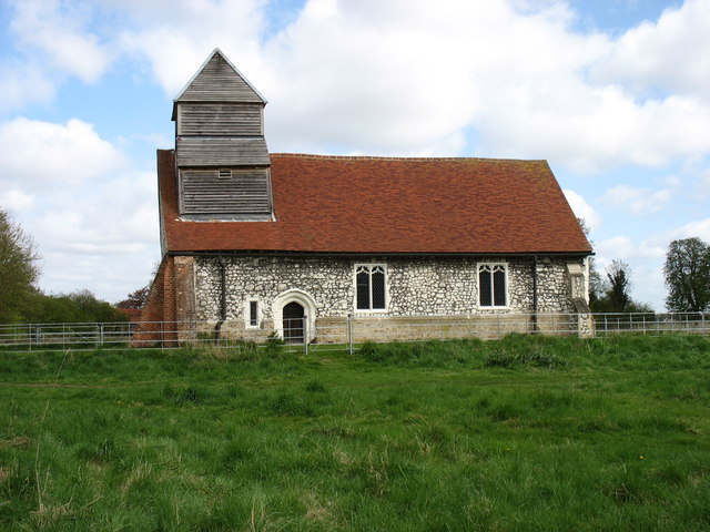
Image: © David Purchase Taken: 29 Apr 2013
This attractive but disused church stands by the Thames Path, and is now maintained by the 'Friends of Friendless Churches'. Most previous photos of the church have been entered for square Image My own GPS readings suggested that the west (left hand) end was about 12 metres inside SU9377, so probably the 94 eastings grid line bisects the church! But we know that hand-held GPS units have a margin of error, an error which is greater than the quoted accuracy unless the unit is given 5 or 10 minutes to 'settle'. Whatever the true position, I cannot criticise any previous submitter for their choice of square, whichever it was.
Images are licensed for reuse under creativecommons.org/licenses/by-sa/2.0
Image Location
Latitude
51.490357
Longitude
-0.647759