Sorn,Conservation Village
Introduction
The photograph on this page of Sorn,Conservation Village by Bob Forrest as part of the Geograph project.
The Geograph project started in 2005 with the aim of publishing, organising and preserving representative images for every square kilometre of Great Britain, Ireland and the Isle of Man.

There are currently over 7.5m images from over 14,400 individuals and you can help contribute to the project by visiting https://www.geograph.org.uk
Sorn,Conservation Village
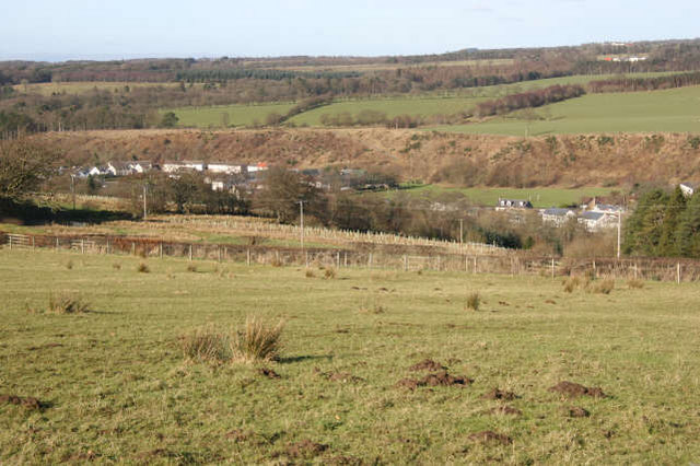
Image: © Bob Forrest Taken: 18 Feb 2007
This shows the geographical location of Sorn from the south-east. The village over the course of time has expanded over the floodplain of the R.Ayr to the steep slopes marking the edge of a former floodplain. The generally flat feature above the village,backed by the gentle slopes rising up to Blindburn Farm in the photograph, is called a river terrace.
Images are licensed for reuse under creativecommons.org/licenses/by-sa/2.0
Image Location
Latitude
55.511061
Longitude
-4.286636