River Terrace
Introduction
The photograph on this page of River Terrace by Bob Forrest as part of the Geograph project.
The Geograph project started in 2005 with the aim of publishing, organising and preserving representative images for every square kilometre of Great Britain, Ireland and the Isle of Man.

There are currently over 7.5m images from over 14,400 individuals and you can help contribute to the project by visiting https://www.geograph.org.uk
River Terrace
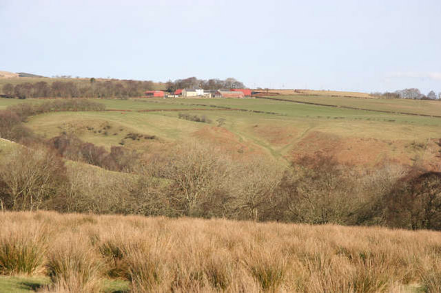
Image: © Bob Forrest Taken: 18 Feb 2007
During the Quaternary period, the valley of the R.Ayr was filled by ice which deposited a considerable depth of glacial till. As the ice melted with a return to warmer conditions, huge volumes of meltwater were released along the centre of the valley and eroded the glacial till down to the present floodplain level. At the valley sides these generally flat surfaces were left to show where there had existed an earlier floodplain. In the background can be seen Nethershield Farm and the present land use of the dissected river terrace on the northern side of the Ayr valley east of Sorn.
Images are licensed for reuse under creativecommons.org/licenses/by-sa/2.0
Image Location
Latitude
55.511613
Longitude
-4.247072