Demolition of Unity House, Hanley
Introduction
The photograph on this page of Demolition of Unity House, Hanley by Steven Birks as part of the Geograph project.
The Geograph project started in 2005 with the aim of publishing, organising and preserving representative images for every square kilometre of Great Britain, Ireland and the Isle of Man.

There are currently over 7.5m images from over 14,400 individuals and you can help contribute to the project by visiting https://www.geograph.org.uk
Demolition of Unity House, Hanley
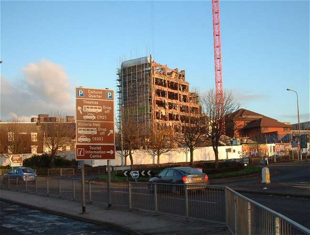
Image: © Steven Birks Taken: Unknown
Stoke City Council's 18-storey former headquarters was the 240-foot-high Unity House, built in the mid-1970s on a site previously occupied by prefab houses near Broad Street, Hanley. Photo taken in Broad Street, just outside the Black Lion pub. http://www.geograph.org.uk/photo/343430 Unity House (the old Civic Centre) stands just off The Potteries Way
Images are licensed for reuse under creativecommons.org/licenses/by-sa/2.0
Image Location
Latitude
53.021958
Longitude
-2.180345