Kintra Street
Introduction
The photograph on this page of Kintra Street by Richard Webb as part of the Geograph project.
The Geograph project started in 2005 with the aim of publishing, organising and preserving representative images for every square kilometre of Great Britain, Ireland and the Isle of Man.

There are currently over 7.5m images from over 14,400 individuals and you can help contribute to the project by visiting https://www.geograph.org.uk
Kintra Street
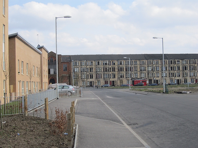
Image: © Richard Webb Taken: 9 Apr 2013
An area undergoing redevelopment with new houses on the north side. To the south there is a large area of grassland where the previous houses have been demolished. The tenements are on Briton Street.Maps show this remained open land long after much of industrial Govan was built and three oval residential blocks built sometime in the 20th century.
Images are licensed for reuse under creativecommons.org/licenses/by-sa/2.0
Image Location
Latitude
55.857246
Longitude
-4.307097