Pleasley NG19, Near Mansfield, Notts.
Introduction
The photograph on this page of Pleasley NG19, Near Mansfield, Notts. by David Hallam-Jones as part of the Geograph project.
The Geograph project started in 2005 with the aim of publishing, organising and preserving representative images for every square kilometre of Great Britain, Ireland and the Isle of Man.

There are currently over 7.5m images from over 14,400 individuals and you can help contribute to the project by visiting https://www.geograph.org.uk
Pleasley NG19, Near Mansfield, Notts.
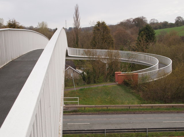
Image: © David Hallam-Jones Taken: 28 Apr 2013
Church Lane was divided into two by the construction of Chesterfield Road North (the A617 dual-carriageway) - date unknown - and as a result pedestrians wishing to access either Common Lane, Outgang Lane or St Michael's Church on the other side of the A617, tend to use this footbridge to save themselves a detour of a mile or so. It is wheelchair-friendly but is said to be "unsuitable for horses".
Images are licensed for reuse under creativecommons.org/licenses/by-sa/2.0
Image Location
Latitude
53.174239
Longitude
-1.247282