Brynmelyn chapel
Introduction
The photograph on this page of Brynmelyn chapel by Dewi as part of the Geograph project.
The Geograph project started in 2005 with the aim of publishing, organising and preserving representative images for every square kilometre of Great Britain, Ireland and the Isle of Man.

There are currently over 7.5m images from over 14,400 individuals and you can help contribute to the project by visiting https://www.geograph.org.uk
Brynmelyn chapel
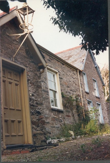
Image: © Dewi Taken: Unknown
The door to the chapel and the chapel house c1985. The site was surrounded by trees and it was not possible to get a wider view.
Images are licensed for reuse under creativecommons.org/licenses/by-sa/2.0
Image Location
Latitude
52.930873
Longitude
-4.171494