Dean House
Introduction
The photograph on this page of Dean House by Stuart Logan as part of the Geograph project.
The Geograph project started in 2005 with the aim of publishing, organising and preserving representative images for every square kilometre of Great Britain, Ireland and the Isle of Man.

There are currently over 7.5m images from over 14,400 individuals and you can help contribute to the project by visiting https://www.geograph.org.uk
Dean House
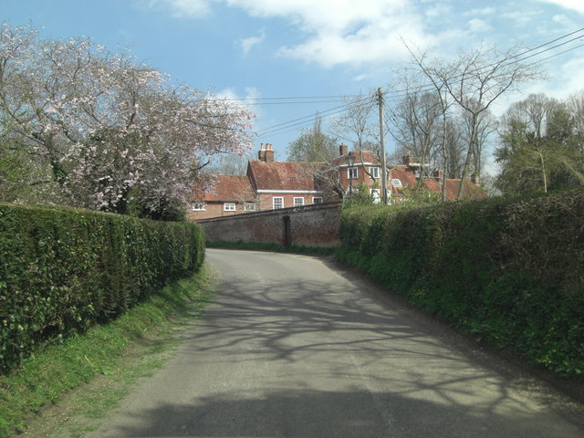
Image: © Stuart Logan Taken: 25 Apr 2013
Dean House is a Grade II* listed rectory with English Heritage Building ID: 141047. It was built during the latter part of the 17th C and early 18th C. Half of it sits in Hampshire, whilst the garden wall and west wing are in Wiltshire. The road is named Rectory Hill.
Images are licensed for reuse under creativecommons.org/licenses/by-sa/2.0
Image Location
Latitude
51.04421
Longitude
-1.633926