The Cenotaph and Memorial Gardens, Rochdale, Lancashire
Introduction
The photograph on this page of The Cenotaph and Memorial Gardens, Rochdale, Lancashire by Dr Neil Clifton as part of the Geograph project.
The Geograph project started in 2005 with the aim of publishing, organising and preserving representative images for every square kilometre of Great Britain, Ireland and the Isle of Man.

There are currently over 7.5m images from over 14,400 individuals and you can help contribute to the project by visiting https://www.geograph.org.uk
The Cenotaph and Memorial Gardens, Rochdale, Lancashire
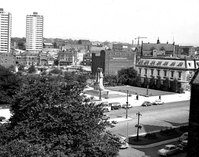
Image: © Dr Neil Clifton Taken: 16 Aug 1966
This is 1966, and in the two years since my previous photograph, two new tower blocks have arrived on the scene. Much rebuilding was going on, but the Salvation Army citadel and the Hippodrome still survive.
Images are licensed for reuse under creativecommons.org/licenses/by-sa/2.0
Image Location


Leaflet Map data © OpenStreetMap
Latitude
53.616135
Longitude
-2.16322