Knockmore Halt
Introduction
The photograph on this page of Knockmore Halt by Wilson Adams as part of the Geograph project.
The Geograph project started in 2005 with the aim of publishing, organising and preserving representative images for every square kilometre of Great Britain, Ireland and the Isle of Man.

There are currently over 7.5m images from over 14,400 individuals and you can help contribute to the project by visiting https://www.geograph.org.uk
Knockmore Halt
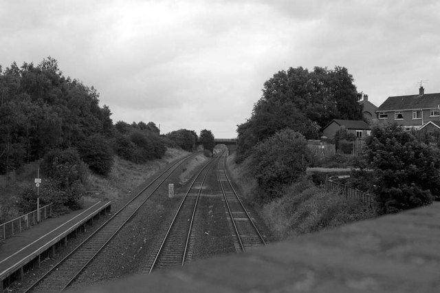
Image: © Wilson Adams Taken: 23 Jul 2005
Knockmore Halt, looking towards Lisburn. The railway line to the left where the platform of the closed Knockmore Halt is, the Antrim Branch, the line in the middle looking towards the Causeway End road bridge, is the Dublin to Belfast Mainline (Down line), to the right, is the Belfast to Dublin (Up line). Causewayend Road Bridge in the Background.
Images are licensed for reuse under creativecommons.org/licenses/by-sa/2.0
Image Location


Leaflet Map data © OpenStreetMap
Latitude
54.511207
Longitude
-6.06893