Doonan Waterfall, Glencloy
Introduction
The photograph on this page of Doonan Waterfall, Glencloy by Robert Ashby as part of the Geograph project.
The Geograph project started in 2005 with the aim of publishing, organising and preserving representative images for every square kilometre of Great Britain, Ireland and the Isle of Man.

There are currently over 7.5m images from over 14,400 individuals and you can help contribute to the project by visiting https://www.geograph.org.uk
Doonan Waterfall, Glencloy
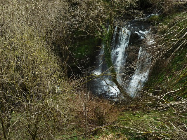
Image: © Robert Ashby Taken: 24 Apr 2013
Doonan Leap is about two miles up the Glencloy River from Carnlough beach. The viewing platform with information panel is in a layby just off the A 42 Carnlough Rd on the left coming from Carnlough and can be difficult to spot from a car. To the best of my knowledge this is the only place where the waterfall can be seen as it is in a deep gorge about 50 feet below the viewpoint and is inaccessible short of wading up the river from its mouth at the beach. It was hidden from view by bushes and small trees which were cut back when the viewing platform was installed by Larne Council.
Images are licensed for reuse under creativecommons.org/licenses/by-sa/2.0
Image Location
Latitude
54.959901
Longitude
-6.013423