Summer House Hill, Talygopa
Introduction
The photograph on this page of Summer House Hill, Talygopa by Alan Richards as part of the Geograph project.
The Geograph project started in 2005 with the aim of publishing, organising and preserving representative images for every square kilometre of Great Britain, Ireland and the Isle of Man.

There are currently over 7.5m images from over 14,400 individuals and you can help contribute to the project by visiting https://www.geograph.org.uk
Summer House Hill, Talygopa
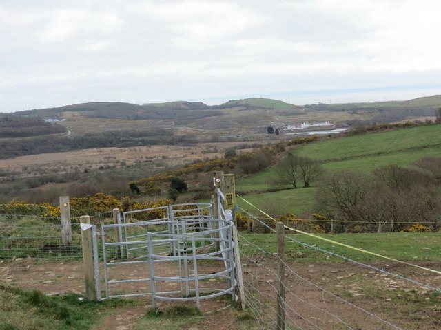
Image: © Alan Richards Taken: 23 Apr 2013
Gatiau moch ar fryn o'r enw Summer House Hill. Ar hen fapiau ei enw yw 'Cae Cobyn Hill'. Yn y pellter gellir gweld Cors Crumlin. Miloedd o flynyddoedd yn ol llifai Afon Nedd drwy'r safle cyn newid ei chwrs a dilyn ei hynt presennol. Kissing gates on a hill known as Summer House Hill, Talygopa. On old maps its name is 'Cae Cobyn Hill'. In the distance one can see Crymlyn Bog. Thousands of years ago the River Neath flowed along here before changing its course and following its present route.
Images are licensed for reuse under creativecommons.org/licenses/by-sa/2.0
Image Location
Latitude
51.653888
Longitude
-3.882779