Graveyard at Gracehill
Introduction
The photograph on this page of Graveyard at Gracehill by Kenneth Allen as part of the Geograph project.
The Geograph project started in 2005 with the aim of publishing, organising and preserving representative images for every square kilometre of Great Britain, Ireland and the Isle of Man.

There are currently over 7.5m images from over 14,400 individuals and you can help contribute to the project by visiting https://www.geograph.org.uk
Graveyard at Gracehill
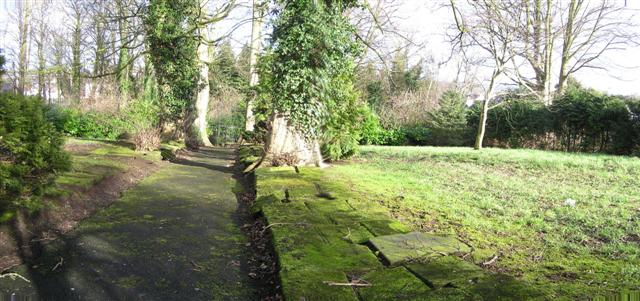
Image: © Kenneth Allen Taken: 17 Feb 2007
For Moravians, the burial ground was known as "Gods Acre" and had a strict layout. Men were buried to the left and women to the right of a central path. All the headstones were of the same shape and design - the Moravians believe that everyone is equal in death - and were laid almost flat on the ground. http://www.bbc.co.uk/northernireland/yourplaceandmine/antrim/gracehill_graves.shtml
Images are licensed for reuse under creativecommons.org/licenses/by-sa/2.0
Image Location
Latitude
54.852456
Longitude
-6.330138