Culvert, Dundonald
Introduction
The photograph on this page of Culvert, Dundonald by Albert Bridge as part of the Geograph project.
The Geograph project started in 2005 with the aim of publishing, organising and preserving representative images for every square kilometre of Great Britain, Ireland and the Isle of Man.

There are currently over 7.5m images from over 14,400 individuals and you can help contribute to the project by visiting https://www.geograph.org.uk
Culvert, Dundonald
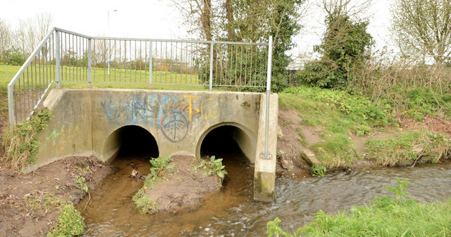
Image: © Albert Bridge Taken: 18 Apr 2013
A culvert, under the East Link Road, in Moat Park, beside the confluence of two streams (not named on the 1:12,000 map). After merging they continue as shown in Image to join the Enler River.
Images are licensed for reuse under creativecommons.org/licenses/by-sa/2.0
Image Location
Latitude
54.593577
Longitude
-5.809261