Seismic survey vehicle at the 76m spot height
Introduction
The photograph on this page of Seismic survey vehicle at the 76m spot height by Chris as part of the Geograph project.
The Geograph project started in 2005 with the aim of publishing, organising and preserving representative images for every square kilometre of Great Britain, Ireland and the Isle of Man.

There are currently over 7.5m images from over 14,400 individuals and you can help contribute to the project by visiting https://www.geograph.org.uk
Seismic survey vehicle at the 76m spot height
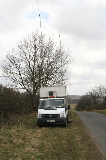
Image: © Chris Taken: 4 Apr 2013
Having noticed orange cabling stretching for miles along the roadside, I traced it back to this survey vehicle. Various vehicles along the route were also equipped with aerials, and there was a monitor screen and operative in the back of the vehicle. It transpires that the seismic survey is being carried out by Egdon Resources, whose business is extracting oil and gas. They have oil wells in the area already, and have just discovered a large oil field near Biscathorpe, a bit further south in the Wolds. Obviously their interest in gas suggests there may be a potential for gas extraction, i.e. "fracking".
Images are licensed for reuse under creativecommons.org/licenses/by-sa/2.0
Image Location
Latitude
53.506036
Longitude
-0.209452