Hardwick Road
Introduction
The photograph on this page of Hardwick Road by Ian Capper as part of the Geograph project.
The Geograph project started in 2005 with the aim of publishing, organising and preserving representative images for every square kilometre of Great Britain, Ireland and the Isle of Man.

There are currently over 7.5m images from over 14,400 individuals and you can help contribute to the project by visiting https://www.geograph.org.uk
Hardwick Road
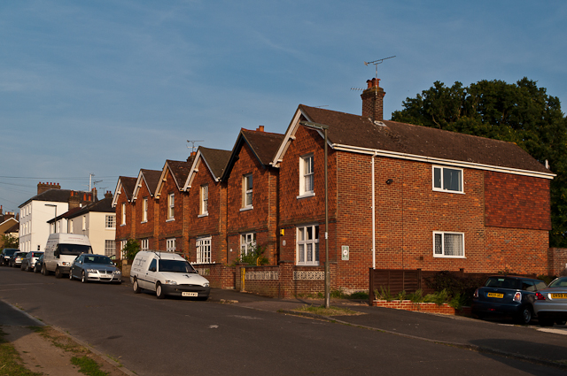
Image: © Ian Capper Taken: 2 Jun 2011
Unusual row of detached houses in Hardwick Road, built around the turn of the 19th/20th century. The large white house in the background is locally listed, as is the first one beyond the main row. The road was shown as Hardwick Road on the 1896 1:2500 map, but Hardwicke Road on the 1913-4 and 1935 editions before reverting to it current name in the 1962-3 version, presumably to avoid confusion with Hardwicke Road in Reigate (see Image).
Images are licensed for reuse under creativecommons.org/licenses/by-sa/2.0
Image Location
Latitude
51.226659
Longitude
-0.189196