Graveney Hill
Introduction
The photograph on this page of Graveney Hill by Penny Mayes as part of the Geograph project.
The Geograph project started in 2005 with the aim of publishing, organising and preserving representative images for every square kilometre of Great Britain, Ireland and the Isle of Man.

There are currently over 7.5m images from over 14,400 individuals and you can help contribute to the project by visiting https://www.geograph.org.uk
Graveney Hill
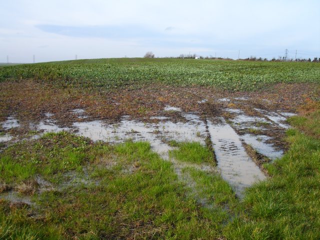
Image: © Penny Mayes Taken: 15 Feb 2007
All of 9 metres above sea level, it doesn't take much to make a hill on the marsh. Recent rain and snow has left this corner water-logged. I think the crop is rape. The white building is close to Cleve Farm Image There was a locally opposed proposal to build a huge substation for the London Array off-shore windfarm hereabouts at the time I took the photo but apparently Shell have now pulled out of the project. Shell had an equal share in the project with power firm E.On and Denmark's Dong energy so I assume, unless another investor can be found, the scheme is now on hold if it hasn't been abandoned altogether.
Images are licensed for reuse under creativecommons.org/licenses/by-sa/2.0
Image Location
Latitude
51.333014
Longitude
0.944289