55-69, Castle Street
Introduction
The photograph on this page of 55-69, Castle Street by Rob Noble as part of the Geograph project.
The Geograph project started in 2005 with the aim of publishing, organising and preserving representative images for every square kilometre of Great Britain, Ireland and the Isle of Man.

There are currently over 7.5m images from over 14,400 individuals and you can help contribute to the project by visiting https://www.geograph.org.uk
55-69, Castle Street
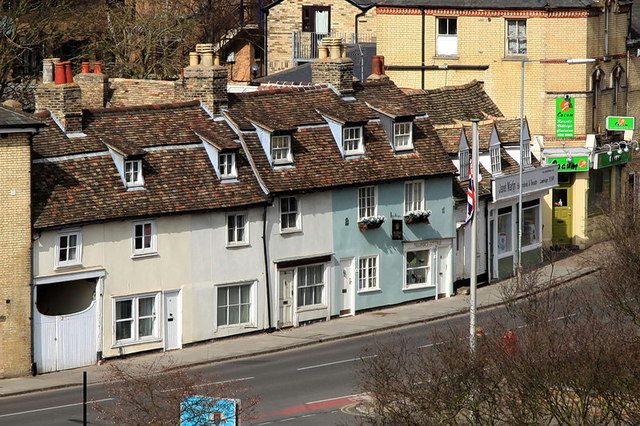
Image: © Rob Noble Taken: 5 Apr 2013
Viewed from the top of Castle Mound - the motte of the former Cambridge Castle - a row of C18 or earlier timber-framed houses and shops, on the old turnpike road to Godmanchester. Grade II listed. Try http://www.britishlistedbuildings.co.uk/en-47386-55-69-castle-street-cambridgeshire
Images are licensed for reuse under creativecommons.org/licenses/by-sa/2.0
Image Location
Latitude
52.212449
Longitude
0.112796