City Of London Boundary Post
Introduction
The photograph on this page of City Of London Boundary Post by Des Blenkinsopp as part of the Geograph project.
The Geograph project started in 2005 with the aim of publishing, organising and preserving representative images for every square kilometre of Great Britain, Ireland and the Isle of Man.

There are currently over 7.5m images from over 14,400 individuals and you can help contribute to the project by visiting https://www.geograph.org.uk
City Of London Boundary Post
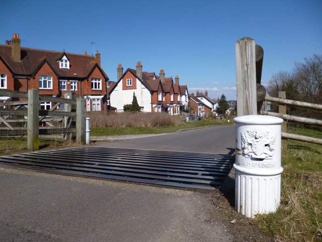
Image: © Des Blenkinsopp Taken: 2 Apr 2013
This is the gate at the north end of Farthing Down, one of seven areas of land purchased in the late 19th century by the Corporation of London especially for public access. The Corporation were concerned that development was engulfing so much land that Londoners would soon have no access to open country within easy reach. Looking at the map, it's still fair to say that these houses beyond the gate are the edge of joined up suburbia. More open scenery begins here. Info on the City Commons on http://www.cityoflondon.gov.uk/things-to-do/green-spaces/city-commons/Pages/City-Commons.aspx
Images are licensed for reuse under creativecommons.org/licenses/by-sa/2.0
Image Location
Latitude
51.31329
Longitude
-0.136125