The Top of Ty'n y Maes Hill
Introduction
The photograph on this page of The Top of Ty'n y Maes Hill by John S Turner as part of the Geograph project.
The Geograph project started in 2005 with the aim of publishing, organising and preserving representative images for every square kilometre of Great Britain, Ireland and the Isle of Man.

There are currently over 7.5m images from over 14,400 individuals and you can help contribute to the project by visiting https://www.geograph.org.uk
The Top of Ty'n y Maes Hill
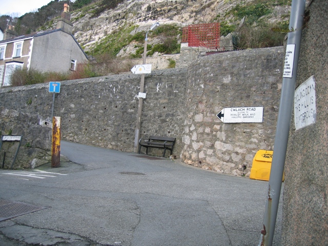
Image: © John S Turner Taken: 15 Feb 2007
At the top of the hill is Cwlach Street, which passes across the photo, and then Cwlach Road, which is higher up and to the left. Cwlach Road leads to Haulfre Gardens and is a no through road, wheareas Cwlach Street is a through road. On the right hand side on the wall is a sign warning of the dangers of cycling down the hill. For a close up of the sign see Image Also see Image for a view of the hill from the bottom.
Images are licensed for reuse under creativecommons.org/licenses/by-sa/2.0
Image Location


Leaflet Map data © OpenStreetMap
Latitude
53.326411
Longitude
-3.837897