Exit from Mulberry Street, Teignmouth
Introduction
The photograph on this page of Exit from Mulberry Street, Teignmouth by Robin Stott as part of the Geograph project.
The Geograph project started in 2005 with the aim of publishing, organising and preserving representative images for every square kilometre of Great Britain, Ireland and the Isle of Man.

There are currently over 7.5m images from over 14,400 individuals and you can help contribute to the project by visiting https://www.geograph.org.uk
Exit from Mulberry Street, Teignmouth
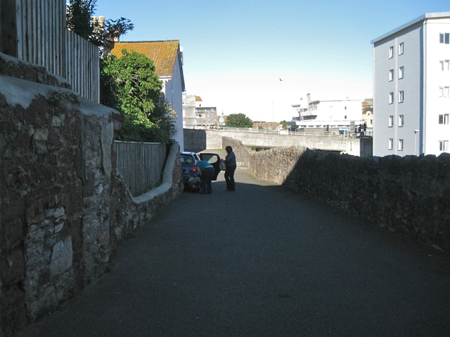
Image: © Robin Stott Taken: 19 Aug 2012
Named on the local street map as Mulberry Street it looks like a private drive off Parson Street. A sign confirms that it is a public right of way. This area of Teignmouth has been fragmented by railway, road and bombing. Note the wall repaired in two stones, left. On the right are the refurbished Parson Street flats.
Images are licensed for reuse under creativecommons.org/licenses/by-sa/2.0
Image Location
Latitude
50.547181
Longitude
-3.50014