Orpington Village Hall
Introduction
The photograph on this page of Orpington Village Hall by Ian Capper as part of the Geograph project.
The Geograph project started in 2005 with the aim of publishing, organising and preserving representative images for every square kilometre of Great Britain, Ireland and the Isle of Man.

There are currently over 7.5m images from over 14,400 individuals and you can help contribute to the project by visiting https://www.geograph.org.uk
Orpington Village Hall
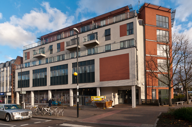
Image: © Ian Capper Taken: 22 Nov 2012
The original Village Hall was built in 1890 to a design of local architect George St Pierre Harris, when Orpington was indeed just a village. It contained a 350 seat concert hall, a billiard room, library and small committee rooms. Other than during the two World Wars, when it served as a hospital, muster point and refuge centre, it continued to provide a social focus for the growing town until the 1960s. For a couple of years from 1927 it was used by the local Presbyterian Church for services, prior to their moving to their permanent site on Knoll Rise, where they built St John's Church (see Image). However, in 1962, the Village Hall was badly damaged by fire, and following neglect over the years, it was eventually demolished in the late 1970s. Work started on a replacement building in 1981, and this was opened the following year, still known as the Village Hall. It contained a single hall on the ground floor with further rooms on the first floor. For a photo, see Image This building lasted 26 years, before being demolished in 2008. Its replacement, opened in October 2010, is a much larger building, which retains the original name. It contains two halls and a small conference room on the second floor. The larger of the two halls is named after Alfred Brown, who had funded the original Village Hall, the smaller hall is named after Aubrey Mullock, an Orpington estate agent who was the driving force behind much of the development of the town in the inter-war years as well as a number of community organisations, while the conference room is named after Frank Whymark, who had ensured the eventual replacement of the original Hall by the 1982 building. The top three floors contain 19 apartments. When opened in 2010, the ground floor, intended to house a restaurant, remained vacant. Here, two years later, there is sign of development, although it subsequently became clear that only a small part of the ground floor was going to be used - see Image For a previous view see Image
Images are licensed for reuse under creativecommons.org/licenses/by-sa/2.0
Image Location
Latitude
51.373514
Longitude
0.097908