Goldhawk Road
Introduction
The photograph on this page of Goldhawk Road by Derek Harper as part of the Geograph project.
The Geograph project started in 2005 with the aim of publishing, organising and preserving representative images for every square kilometre of Great Britain, Ireland and the Isle of Man.

There are currently over 7.5m images from over 14,400 individuals and you can help contribute to the project by visiting https://www.geograph.org.uk
Goldhawk Road
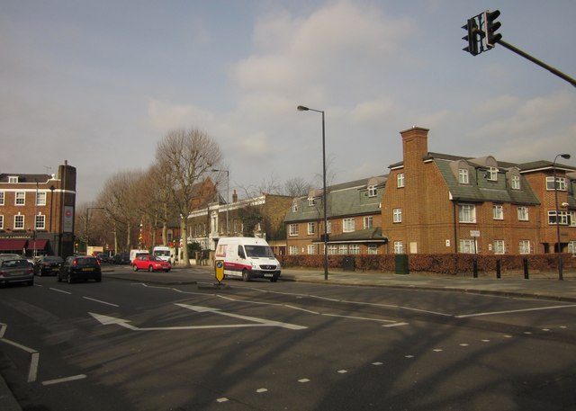
Image: © Derek Harper Taken: 21 Mar 2013
The A402 at its junction with the B409 Stamford Brook Road. Here the A road bends left to Stamford Brook. The blocked-off road on the right is Rylett Road. The building beside it is John Betts’ House, completed in 1964, and providing 35 flats as part of Hammersmith United Charities http://hamunitedcharities.org.uk/housing/john-betts-house . Beyond the terrace, which straddles a gridline, is St Mary's Court, apartments created in a redundant church (1886) also shown in Image On the extreme left is the former Queen of England pub, dating from 1926 and designed by G G MacFarlane. It is now the Pacific Bar.
Images are licensed for reuse under creativecommons.org/licenses/by-sa/2.0
Image Location
Latitude
51.498756
Longitude
-0.243395