Mint Wall
Introduction
The photograph on this page of Mint Wall by Richard Croft as part of the Geograph project.
The Geograph project started in 2005 with the aim of publishing, organising and preserving representative images for every square kilometre of Great Britain, Ireland and the Isle of Man.

There are currently over 7.5m images from over 14,400 individuals and you can help contribute to the project by visiting https://www.geograph.org.uk
Mint Wall
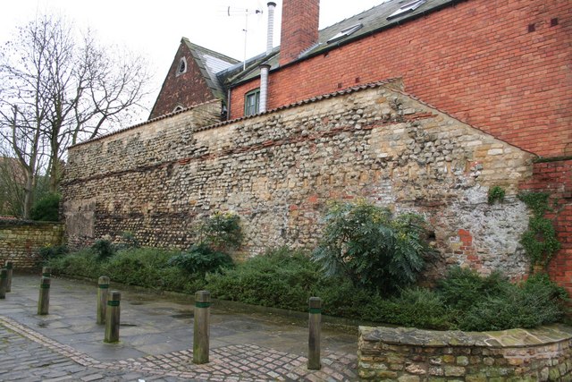
Image: © Richard Croft Taken: 6 Feb 2007
Late 2nd / early 3rd century stretch of Roman wall that was part of the outer wall of the basilica, the northern range of the forum complex of Lindum Colonia. The 18th century Lincolnshire antiquarian William Stukeley erroneously named it 'mint wall' and the name has stuck. The wall is 23m (76 feet) long and 7m (23ft) high, with about 2m (6ft) below ground level.
Images are licensed for reuse under creativecommons.org/licenses/by-sa/2.0
Image Location
Latitude
53.235889
Longitude
-0.538854