Boarded up houses, Great North Way
Introduction
The photograph on this page of Boarded up houses, Great North Way by Robin Webster as part of the Geograph project.
The Geograph project started in 2005 with the aim of publishing, organising and preserving representative images for every square kilometre of Great Britain, Ireland and the Isle of Man.

There are currently over 7.5m images from over 14,400 individuals and you can help contribute to the project by visiting https://www.geograph.org.uk
Boarded up houses, Great North Way
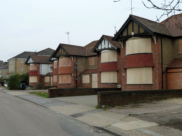
Image: © Robin Webster Taken: 21 Mar 2013
Five of eight semi-detached houses which have been boarded up, no doubt a preliminary to redeveloping the site with higher density housing. This has evidently happened further along the road. The foreground road is a service road parallel with the main carriageways of the A1.
Images are licensed for reuse under creativecommons.org/licenses/by-sa/2.0
Image Location
Latitude
51.597321
Longitude
-0.220103