The Croft, Royal Wootton Bassett
Introduction
The photograph on this page of The Croft, Royal Wootton Bassett by Jaggery as part of the Geograph project.
The Geograph project started in 2005 with the aim of publishing, organising and preserving representative images for every square kilometre of Great Britain, Ireland and the Isle of Man.

There are currently over 7.5m images from over 14,400 individuals and you can help contribute to the project by visiting https://www.geograph.org.uk
The Croft, Royal Wootton Bassett
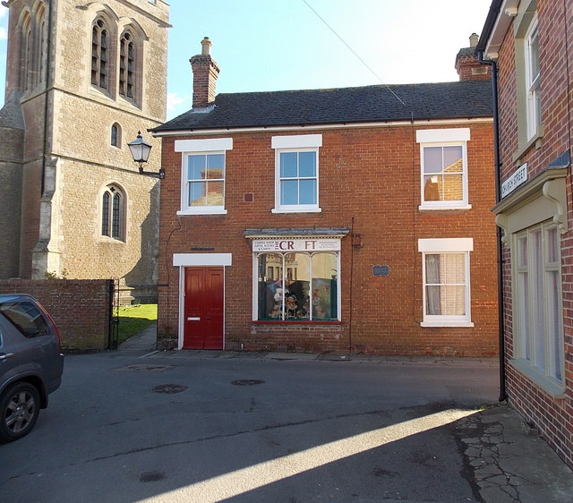
Image: © Jaggery Taken: 2 Feb 2013
Located on the corner of Church Street and Rope Yard, The Croft is the parish office for St Bartholomew and All Saints church, http://www.geograph.org.uk/photo/3378506 a corner of which is on the left. The Croft is also a coffee shop. Gifts, books and cards are on sale. A plaque http://www.geograph.org.uk/photo/3378599 on the building records that this area was formerly reserved for archery practice.
Images are licensed for reuse under creativecommons.org/licenses/by-sa/2.0
Image Location
Latitude
51.541361
Longitude
-1.906515