Kings Norton Junction
Introduction
The photograph on this page of Kings Norton Junction by Gillie Rhodes as part of the Geograph project.
The Geograph project started in 2005 with the aim of publishing, organising and preserving representative images for every square kilometre of Great Britain, Ireland and the Isle of Man.

There are currently over 7.5m images from over 14,400 individuals and you can help contribute to the project by visiting https://www.geograph.org.uk
Kings Norton Junction
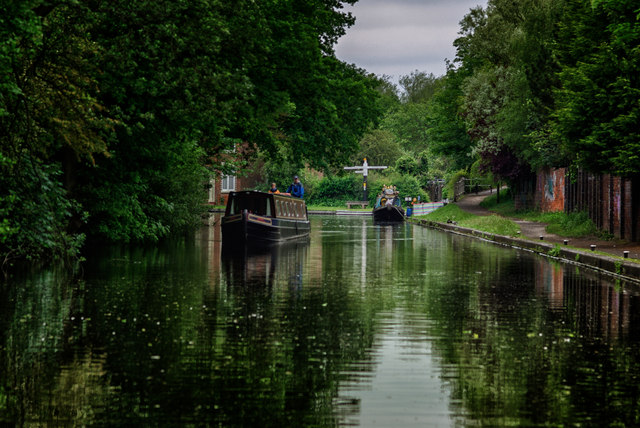
Image: © Gillie Rhodes Taken: 5 Jun 2012
Junction of the Stratford Canal (Northern Section) with the Worcester and Birmingham Canal. The Stratford canal is the one the Narrowboat is cruising on and the Worcester & Birmingham goes from left to right at the fingerpost in the distance. Turn left at the junction and the canal goes to Worcester, turn right and it goes to the middle of Birmingham at Gas Street.
Images are licensed for reuse under creativecommons.org/licenses/by-sa/2.0
Image Location
Latitude
52.412305
Longitude
-1.922479