Bramcote NG9, Notts.
Introduction
The photograph on this page of Bramcote NG9, Notts. by David Hallam-Jones as part of the Geograph project.
The Geograph project started in 2005 with the aim of publishing, organising and preserving representative images for every square kilometre of Great Britain, Ireland and the Isle of Man.

There are currently over 7.5m images from over 14,400 individuals and you can help contribute to the project by visiting https://www.geograph.org.uk
Bramcote NG9, Notts.
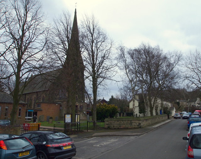
Image: © David Hallam-Jones Taken: 21 Mar 2013
The Church of St Michael and All Angel's on Church Street was built in 1861 to replace the old church, off Town Street, of which only the churchyard and tower remain. This spire is 130ft high. On the left-hand side is the St Michael's Parish Centre, premises that are sandwiched between the church and Bramcote Memorial Hall.
Images are licensed for reuse under creativecommons.org/licenses/by-sa/2.0
Image Location
Latitude
52.935391
Longitude
-1.246819