Patcham Place, Brighton
Introduction
The photograph on this page of Patcham Place, Brighton by Stephen Richards as part of the Geograph project.
The Geograph project started in 2005 with the aim of publishing, organising and preserving representative images for every square kilometre of Great Britain, Ireland and the Isle of Man.

There are currently over 7.5m images from over 14,400 individuals and you can help contribute to the project by visiting https://www.geograph.org.uk
Patcham Place, Brighton
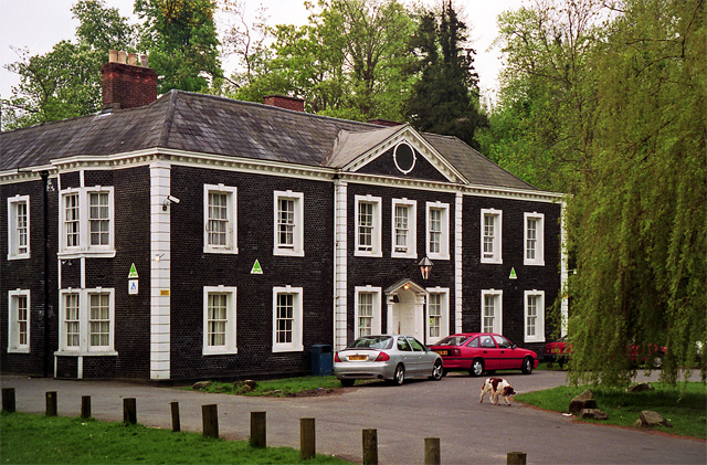
Image: © Stephen Richards Taken: Unknown
The distinctive facing is black mathematical tiles (the quoins are wooden), not uncommon in this part of the world. Mid/late C18th. Grade II* listed. At the time of the photo, which is uncertain, it was used as a youth hostel, but I understand it is currently empty, awaiting new occupants.
Images are licensed for reuse under creativecommons.org/licenses/by-sa/2.0
Image Location
Latitude
50.864899
Longitude
-0.153354