Side of the Richard Greenhow Centre
Introduction
The photograph on this page of Side of the Richard Greenhow Centre by Richard Dorrell as part of the Geograph project.
The Geograph project started in 2005 with the aim of publishing, organising and preserving representative images for every square kilometre of Great Britain, Ireland and the Isle of Man.

There are currently over 7.5m images from over 14,400 individuals and you can help contribute to the project by visiting https://www.geograph.org.uk
Side of the Richard Greenhow Centre
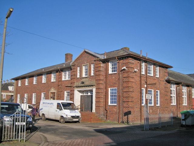
Image: © Richard Dorrell Taken: 25 Feb 2013
This is the south facing side of the building which faces west to Central Avenue. It houses a Community Centre, Function Hall, 3 Meeting Rooms, ICT Room, Day Centre for the Elderly, Library, Fitness Equipment, Kitchen and Bar Facilities. The building was formerly named The Institute, and was a club and recreation centre for munitions workers in HM Factory, Gretna. It was built in 1916.
Images are licensed for reuse under creativecommons.org/licenses/by-sa/2.0
Image Location
Latitude
54.994249
Longitude
-3.066425