The Midland main line north from Sileby
Introduction
The photograph on this page of The Midland main line north from Sileby by Richard Vince as part of the Geograph project.
The Geograph project started in 2005 with the aim of publishing, organising and preserving representative images for every square kilometre of Great Britain, Ireland and the Isle of Man.

There are currently over 7.5m images from over 14,400 individuals and you can help contribute to the project by visiting https://www.geograph.org.uk
The Midland main line north from Sileby
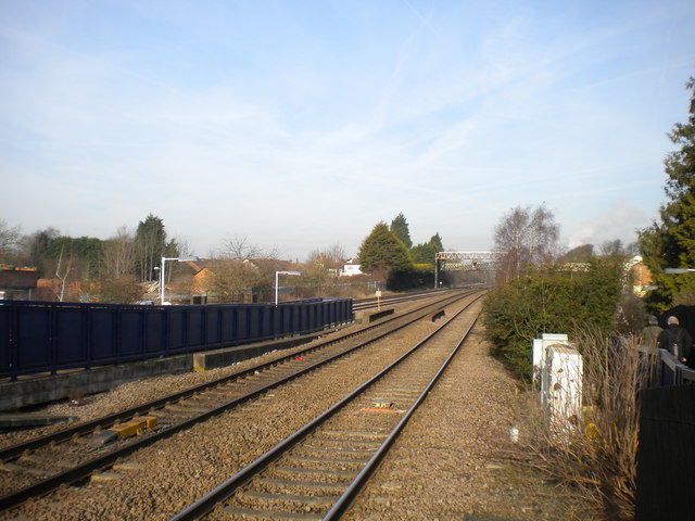
Image: © Richard Vince Taken: 16 Feb 2013
Looking north along the Midland main line from the north end of the up platform at Sileby station. The pair of lines in the foreground are the slow lines, with the fast lines visible in the distance on the left. The blue fencing obscuring them in the foreground lines the stairway from the down platform to the road below.
Images are licensed for reuse under creativecommons.org/licenses/by-sa/2.0
Image Location
Latitude
52.731549
Longitude
-1.110241